NOTE: This text was originally uploaded in 2017 on my PNT hike. Lightly edited for typos.
First off, I’m sorry this post is so long in coming. Typing the posts on my phone takes quite a bit of time, and I was a bit too lazy to type it up on the phone when I knew I had access to a keyboard and large screen coming up when I finished. So I’m writing this now from my parents apartment in Seattle where I’ll be staying for a bit while I settle in and look for work. This should be the first in a few posts about the Islands, Olympics, and a compilation post where I’ll put up some of the videos I took while on trail.
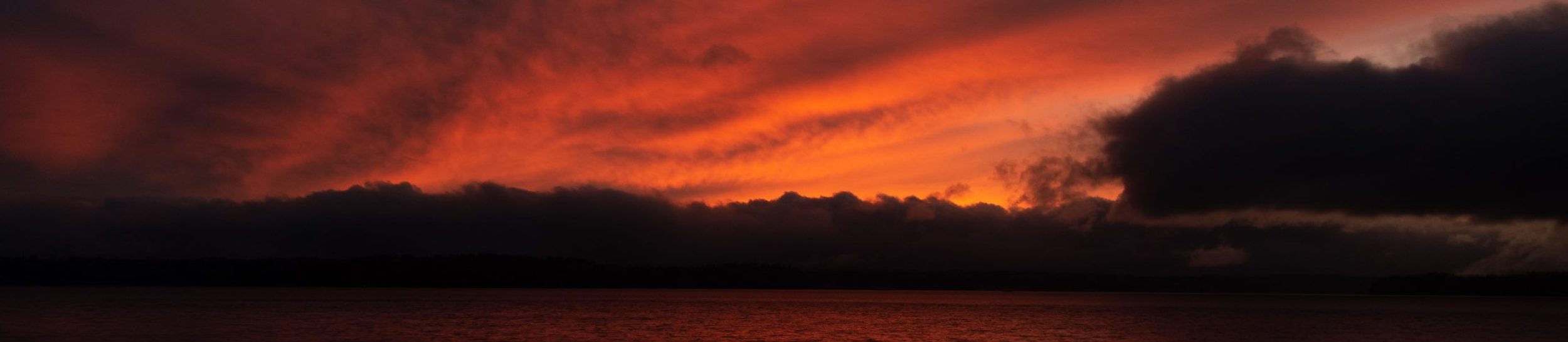
I actually finished on the 13th at 1:30 PM, but between trying to reintegrate and get back up to speed, I’ve been slow to get around to this. The fact that I’m done hasn’t sunk in yet. I’m no longer walking 10-12 hours a day, and not carrying 30 lbs of gear, water, and food everywhere I go, but I haven’t yet felt the sense of accomplishment or finality that I would have expected for such a long undertaking. I had plenty of time to contemplate the trail while on the trail, and did feel that it was coming to an end, especially when I reached the beach for the first time, and again on the last mile to Cape Alava, once I had passed the Wedding Rocks, the site of rock carvings made by the Makah tribe.
Thru-hiking, as an activity/job/hobby, is not one where the finish is the goal. The trip is simply too long and drawn out to make it on sheer will to reach the end alone. You have to enjoy the journey as well to make it succeed. Because of this, I already found the high and low points of the trail. So when the fog descended and the wind moved in and the last 3 miles were loose rock and rotten seaweed, as I reached the western terminus, all I could do was laugh and say “I’d expect nothing less from the PNT”. The trail never let me off easy, and rarely was straightforward and easy. However, it was satisfying. I set out really not sure if I would succeed, but I wanted to test myself and see what I was truly capable of. I think not knowing what to expect besides “its going to be really hard” helped me a bit. When the trail was 55 miles of forest roads before I reached a trail, when the trail was overgrown or non existent, when I had no views for weeks, I had nothing “good” to compare it to and want to stop. I just thought that’s what thru-hiking is. Several other hikers, including those who have triple-crowned (finished the AT, CDT, and PCT, a total of ~7500 miles) have told me that this is the hardest trail they have hiked, so I’m looking forward to trying my feet at the PCT and see what an “easy” trail is like, though the PCT offers a different challenge in being over twice the length of the PNT.
On the PNTA’s website, the director of the PNTA Jeff Kish offers these words to prospective thru-hikers: “I believe that most hikers would benefit significantly from hiking one of the more popular long distance hiking trails first.”. While I met many other first time thru-hikers (more than I would have expected, though we were still a minority), most of who finished, I think I now agree with Jeff, despite my determination beforehand. The Pacific Northwest Trail is as of yet unfinished. I have to go through and figure out how many miles I did on dirt road vs trail vs paved road, but the PNT has a significant amount on road. Some stretches of road are deserted and long, such as 55 miles of road between Northport and the Old stagecoach trail, which is actually just an old road, if you take the alternate to avoid the 2015 burn on the Kettle Crest. Some roads are just plain dangerous to walk, such as the 8 miles up the Mount Baker Highway, a steep winding mountain road filled with tourists. One of the joys of the PNT is the solitude, the fact that you use the underused side trail, the out of the way, deep in the wilderness trail away from the crowds. However, those trails are often overlooked in their maintenance, despite the status as a National Scenic Trail. Several alternates exist to get around sections of the Congressionally designated route that are simply impassible. While the line on the map is easy enough to follow, the trails on the ground are not. The PNT is just simply not ready for many of the people who attempt trails like the AT and the PCT, trails that are well maintained, are easy to follow, and are just that, trails. It’s hard enough thru-hiking between managing your body and your pack; adding in navigation, blowdowns, overgrowth, tedious roadwalks, and the added stress of pavement to your joints make staying motivated much more difficult.
Despite the paragraph above, I don’t regret the PNT. Everyone I met, both thru-hikers on trail and in the towns, was amazingly friendly, and I received trail magic from some pretty unlikely sources. I really got a chance to get to know the 2 dozen or so other thru-hikers in the bubble near me, something that might not have happened with some of the crowds on the other trails. I got to see some spectacular scenery, and spend 9.5 weeks pushing my limits and living outdoors, away from the screen and the rigidity and stresses of daily life. I loved it, and am already thinking about my next thru-hike, though I am glad I’m back in the world of cell service, internet, and water I don’t need to purify before drinking.
I’ll close out, as always, with a few pictures; and the thought that everyone should at some point in their life push themselves to their breaking point and see what they are truly capable of. I think many would be surprised of how far they can make it. I know I was.
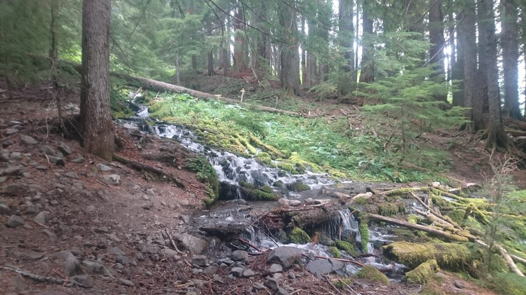
Rocky Creek, coming off of Appleton Pass on my last big day (5500′) of climbing.
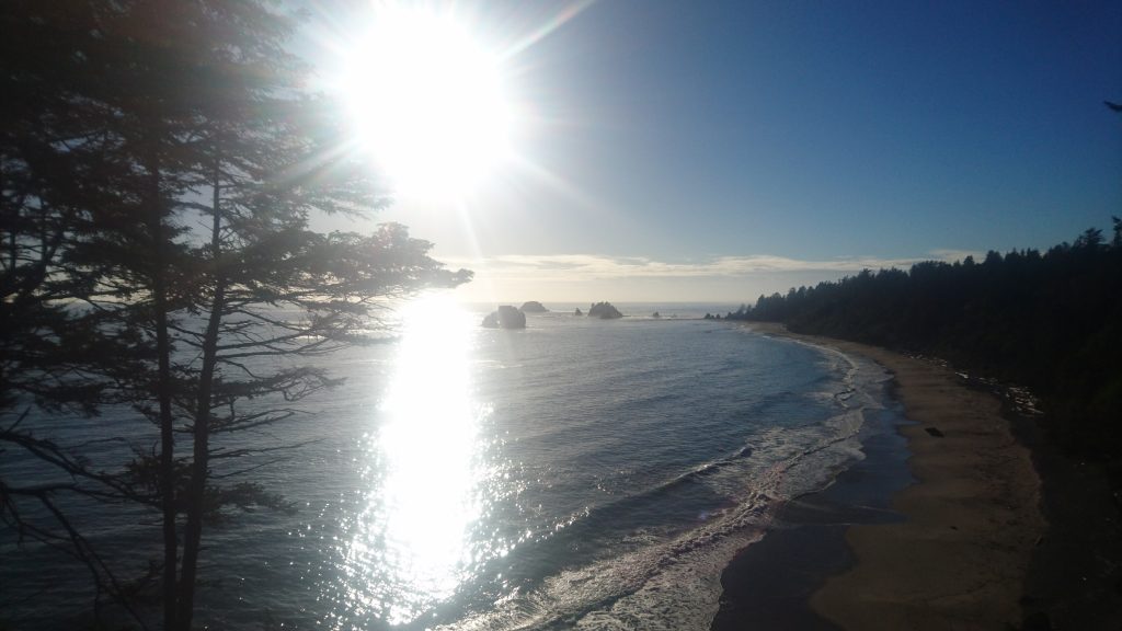
My first view of the beach, it looks so nice!

A small bit of rock ‘art’ I did while at camp at Hole-in-the-Wall.
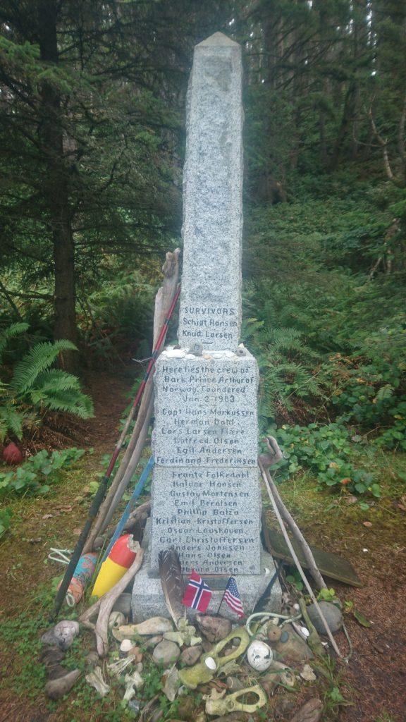
Norwegian Memorial
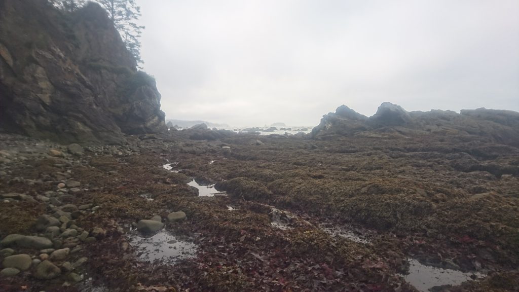
Yes, that is the trail on the beach. ~10 miles of that, or worse between my entry spot and Cape Alava.
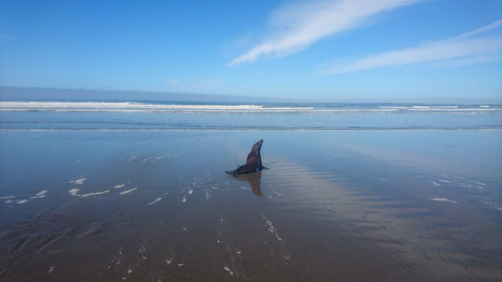
An indignant seal I accidentally woke up from a nap. Sorry seal!
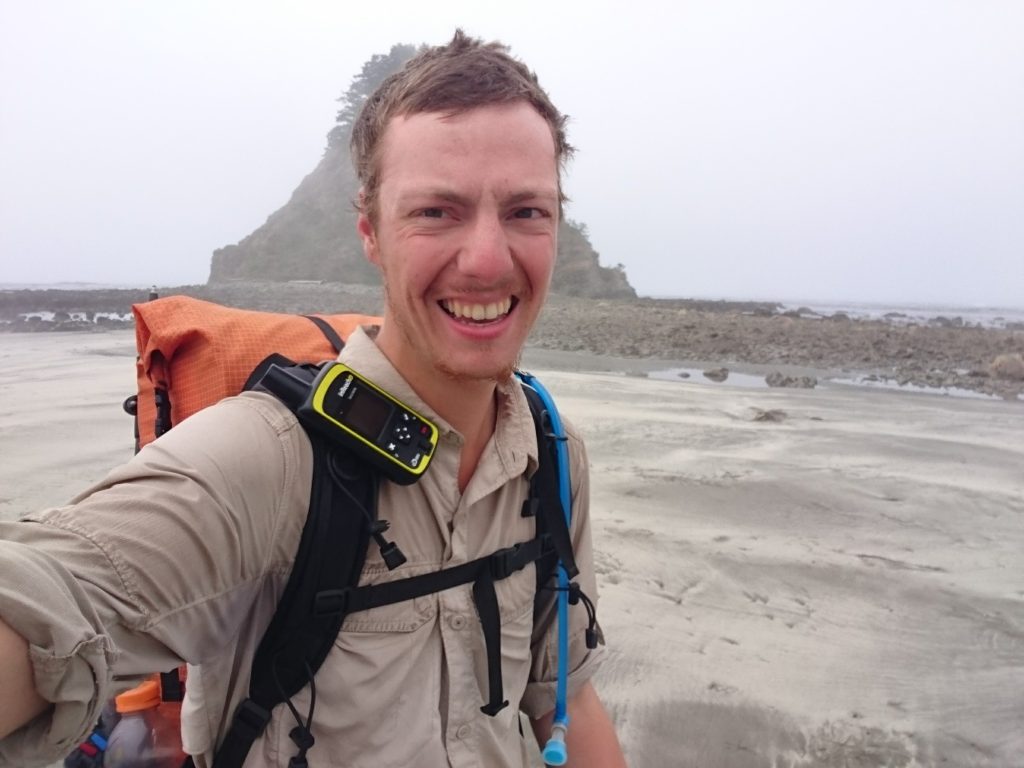
Cape Alava in all its glory
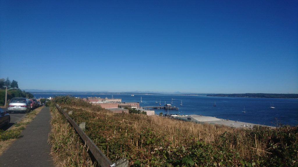
Port Townsend, overlooking the Puget sound and the North Cascades. The smudge of white in the middle of the mountains is Mt Baker.
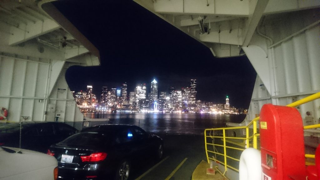
On the ferry from Bainbridge Island to Seattle, back in the city.